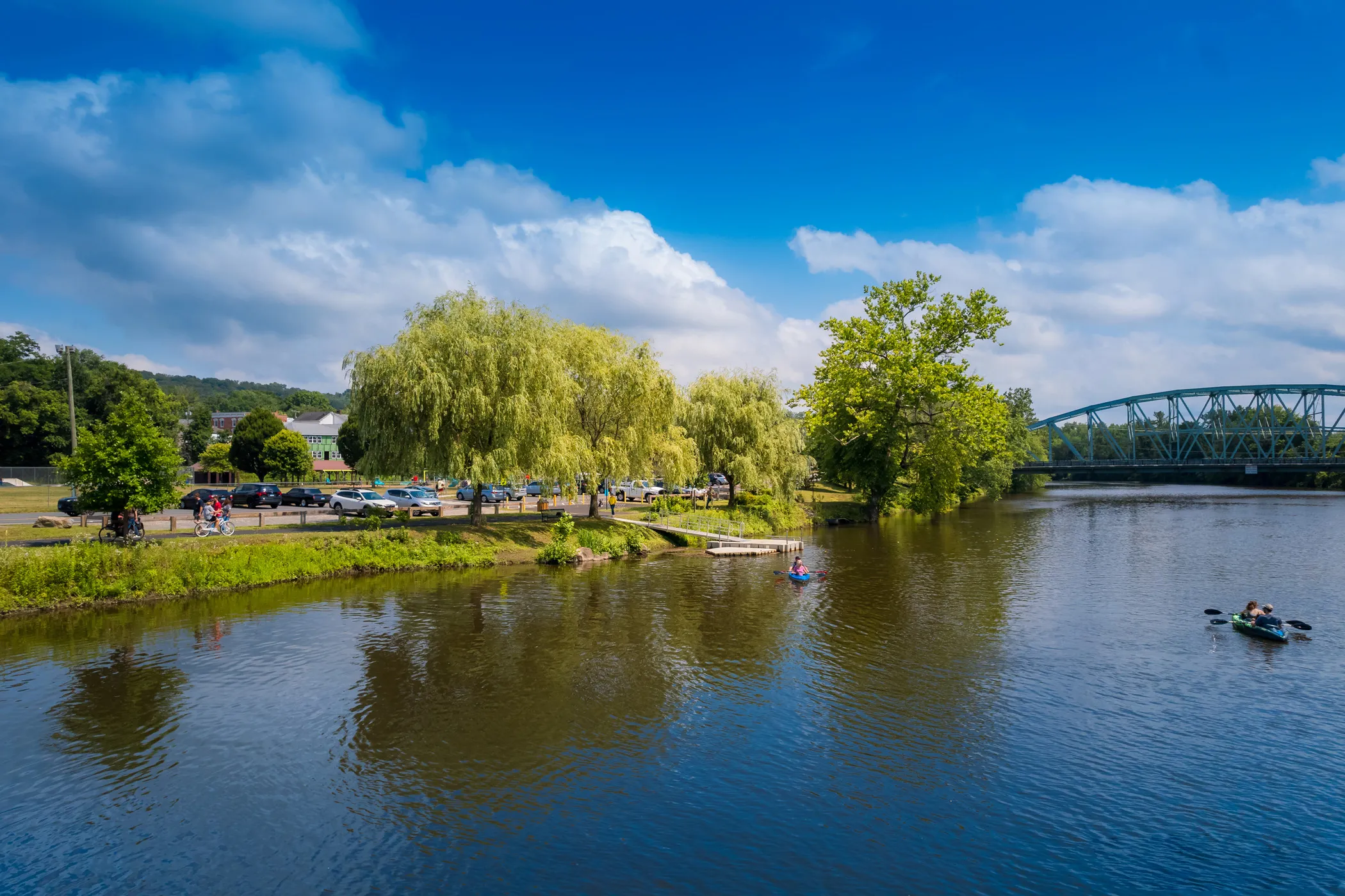
 A Dynamic Riverfront for New Milford
 Wednesday, June 4th 7-9pm
Richmond Senior Center, 40 Main Street, New Milford, CT
Tentatively scheduled for September 2025, details to be announced
Tentatively scheduled for October 2025, details to be announced
What is the New Milford Riverfront Revitalization Project?
The New Milford Riverfront Revitilization is a community-driven effort to create a dynamic, 21st-century riverfront integrated with New Milford's Town Center. The vision is to catalyze community development, resiliency, and revenue generation for the town, while protecting the Housatonic River and its ecosystem.
In 2016, the community mobilized around a more forward-looking vision for the riverfront. The Town adopted a Riverfront and Brownfield Revitilization Master Plan in 2021, with further concept refinements made in 2024.
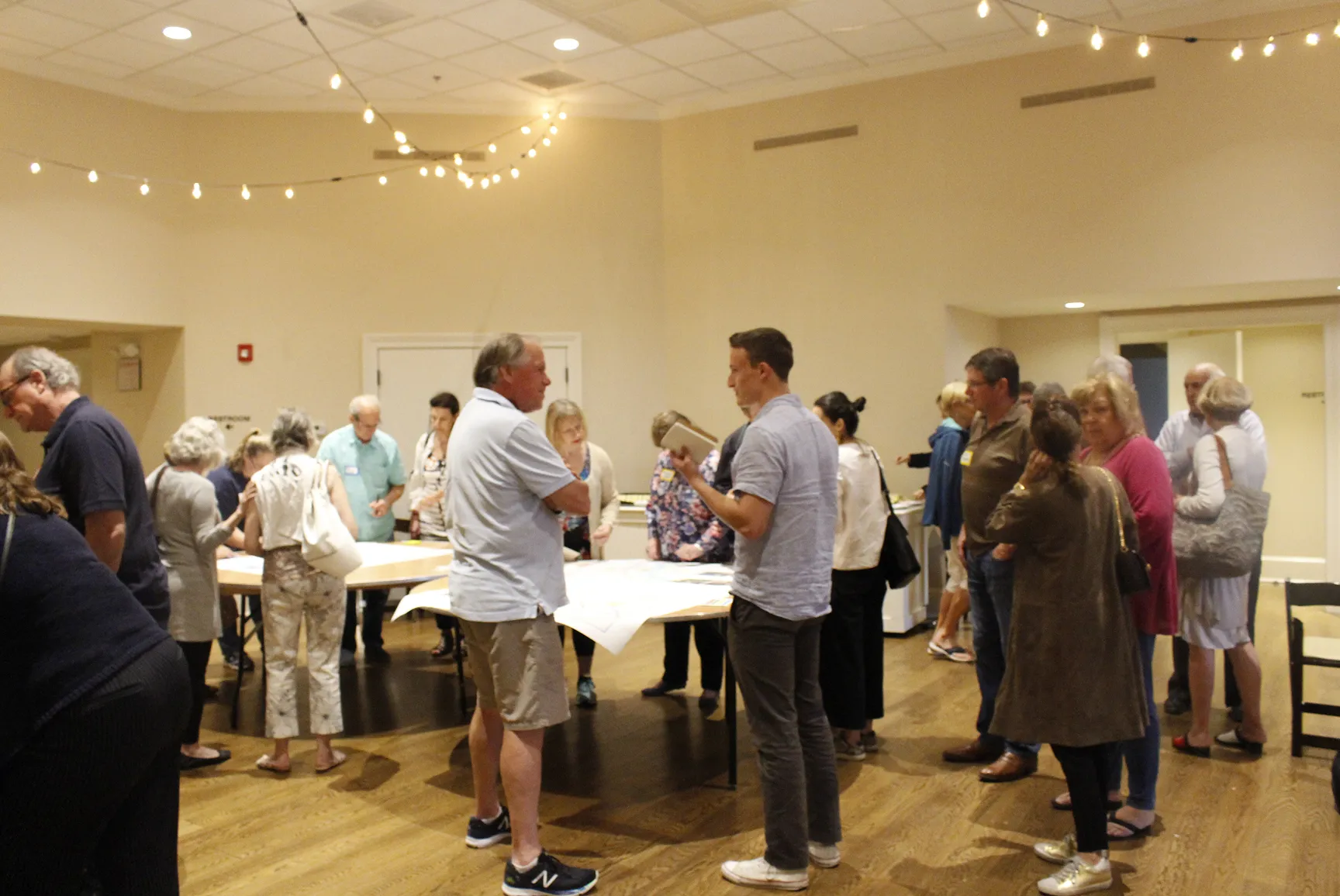
Now entering the design development phase, WXY architecture + urban design and the Riverfront Revitilization Committee are leading an inclusive, participatory process that invites residents, business owners, and community groups to help shape the future of the riverfront.
Riverfront Project Area
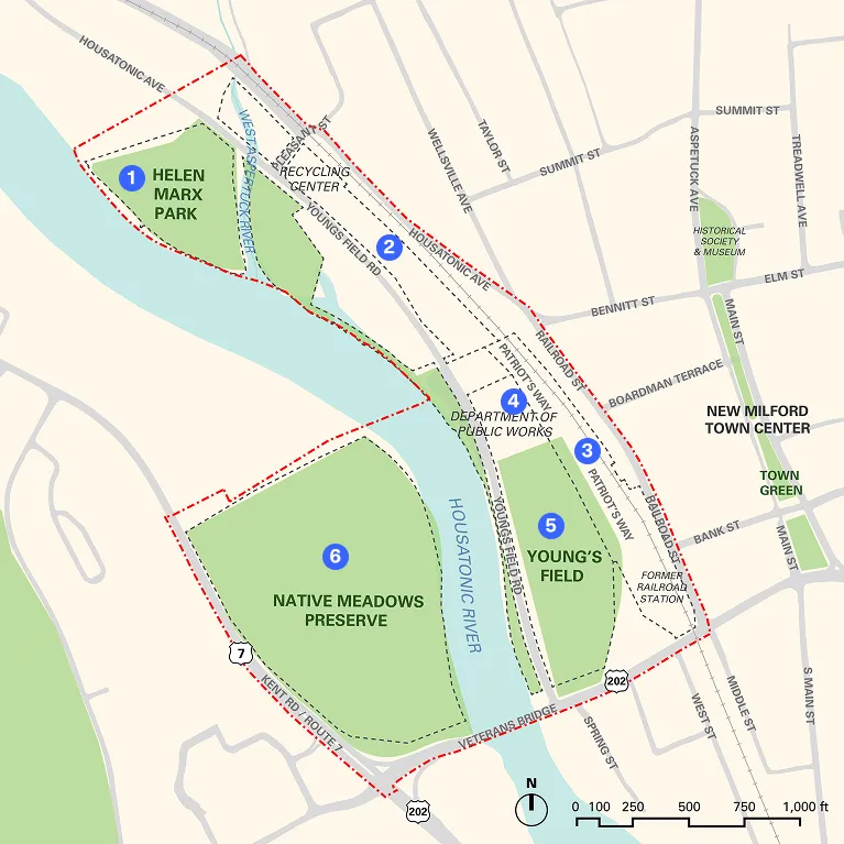
(6.25 acres)
(4.2 acres)
(5.1 acres)
(5.1 acres)
(12.2 acres)
(24.7 acres)

Riverfront Project Principles
Connected and Multimodal
Accessible and Experiential
Sustainable and Innovative
Diverse Uses and Ecosystems
Implementable and Achievable
Multifunctional Riverfront
New Milford
Riverfront Design
Final Submission

The Riverfront Survey is now closed, and we're excited to share that we received over 400 responses. We're deeply grateful to everyone who took the time to participate and share their vision for the future of the New Milford Riverfront.
Stay tuned for more updates and join us at the next local event!
Tentatively scheduled for September 2025, details to be announced
Tentatively scheduled for October 2025, details to be announced
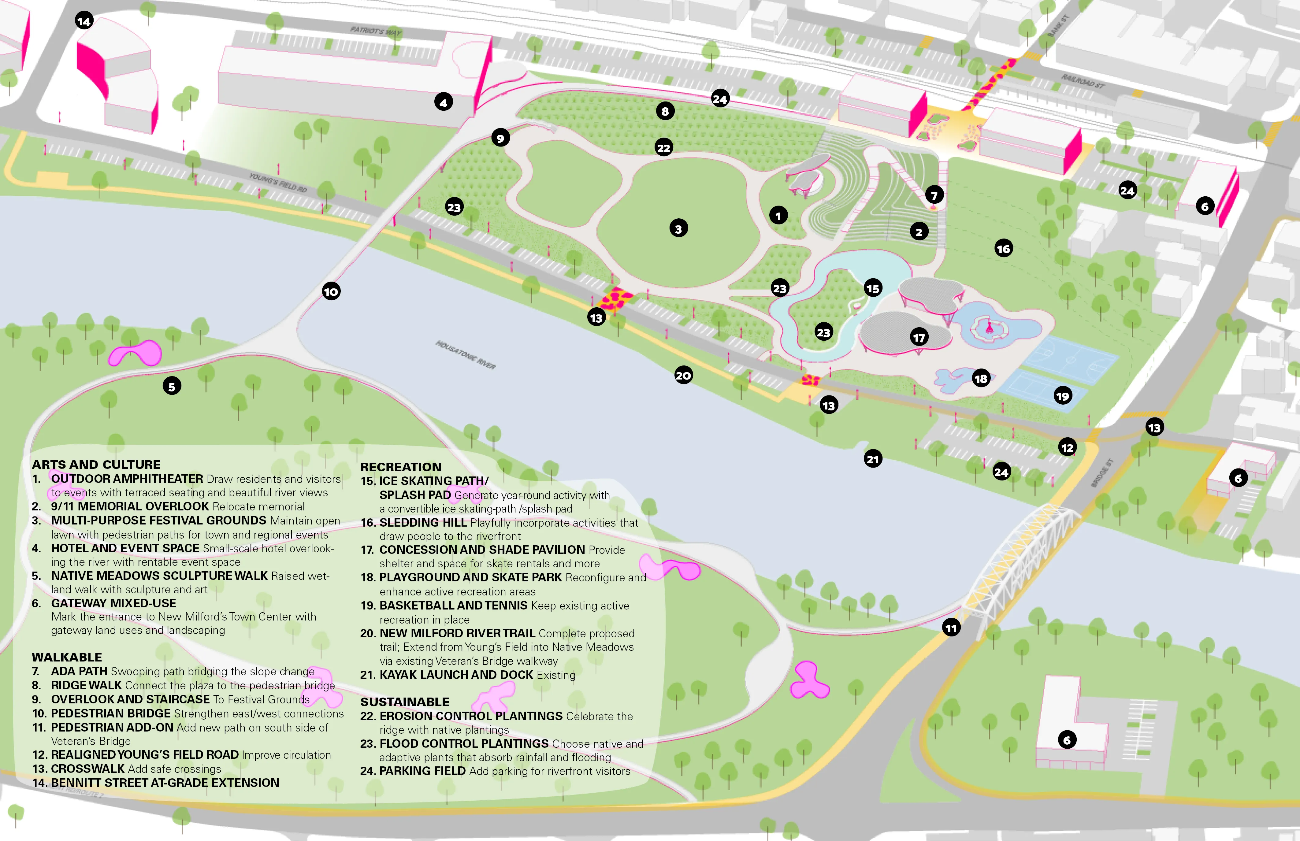
In 2021, the Town adopted an aspirational Concept Plan for the Riverfront, developed by WXY.
The planning process included stakeholder interviews, community visioning and public engagement exercises, consultation with relevant Town departments, and public design charrettes to develop appropriate options and recommendations.
The plan was contingent on relocating the softball fields to another location. It included a pedestrian bridge over the Housatonic to connect the east and west banks and the Young’s Field and Native Meadows areas. It also contemplated multi-use development within Patriot’s Way.
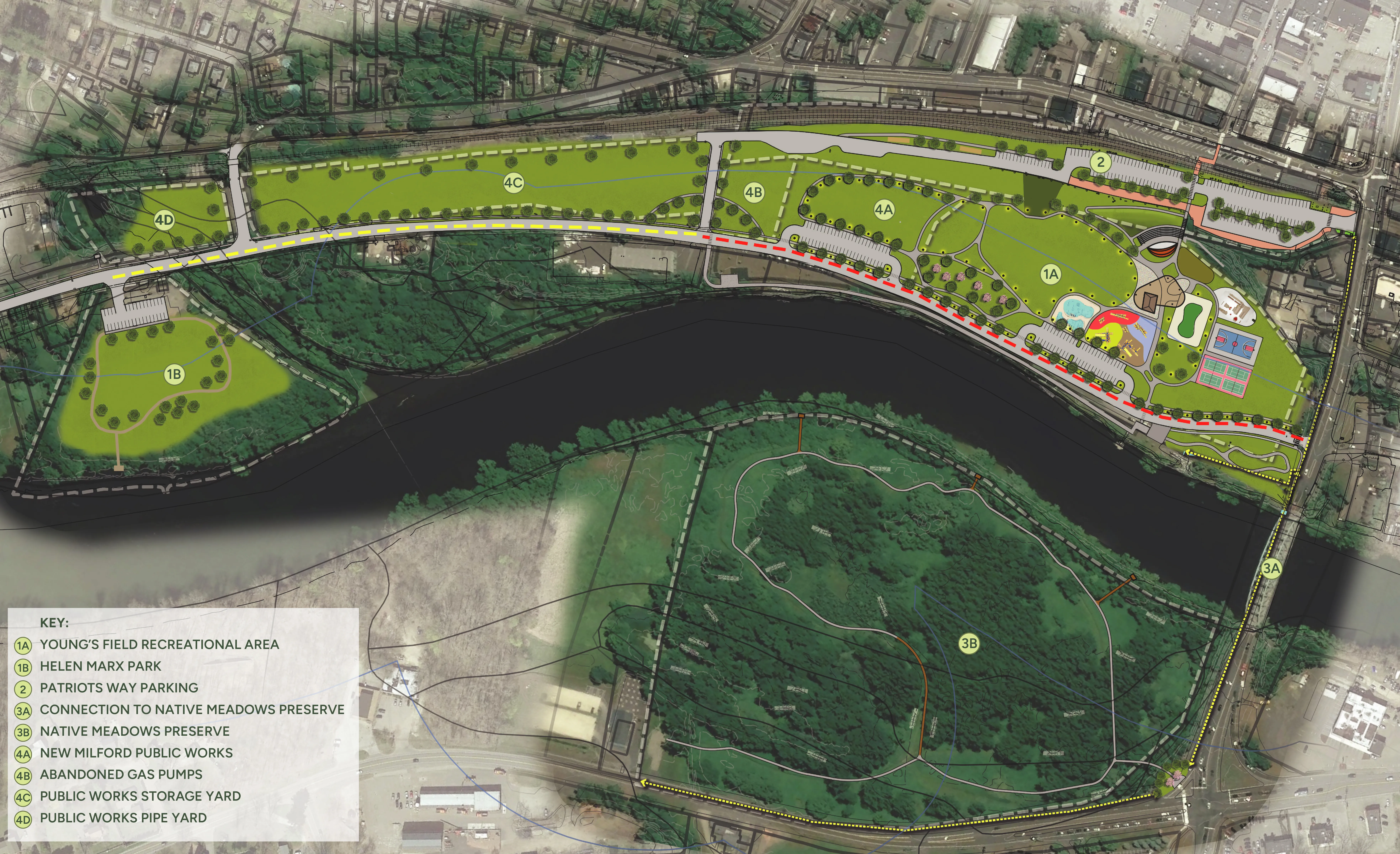
In 2024, the Riverfront Committee further developed the plan.
The updated plan accounts for FEMA mapping and site topography, additional parking, sustainability and flood control mitigation, and contemplates the undergrounding of electrical and utility lines, as well as a possible realignment of Young’ Field Road.
Buildings originally proposed for Patriot’s Way have been removed as has the bridge over the River.
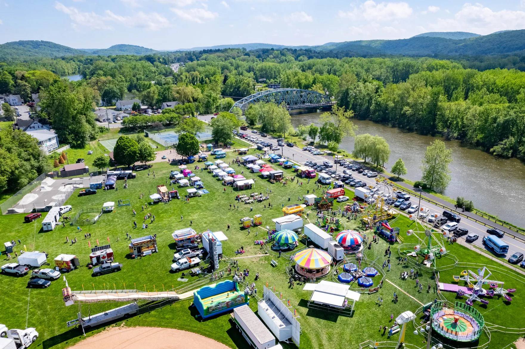
Young’s Field Park remains a green recreational area containing a playground and skateboard area and ball courts. Other suggested improvements are a splash pad, sledding and synthetic ice-skating areas, as well as an amphitheater and festival amenities, a concession stand and restroom areas. An expansion of the River Trail northward to Helen Marks Park is also recommended.
The recreational and infrastructure improvements are drawn to scale, but their locations and configurations are strictly conceptual and will, in all probability, change as the plan evolves from concept to design development.

10 Main St,
New Milford, CT
06776